

Slieve na Calliagh [Sliabh na Cailli]
Good walks are even better shared.
N5877 : A satellite tomb at Carnbane East
Eric Jones Photo source
Overview
Slieve na Calliagh is Meath’s 276 m county top, on Carnbane East near Oldcastle. The Loughcrew passage tombs give this grassy hill its distinctive archaeological setting. The recorded highest point is the top of a chambered cairn, which must not be climbed; the visitor walk reaches the permitted outdoor hilltop beside the monuments.
Slieve na Calliagh: Carnbane East and the Loughcrew cairns
Slieve na Calliagh rises above the countryside near Oldcastle in County Meath. Its 276 m county-top record refers to the summit of a chambered cairn on Carnbane East. The visitor walk reaches the outdoor hilltop beside the monuments: the cairns themselves must not be climbed. Loughcrew names the wider archaeological complex, which also extends onto neighbouring hills.
The combination of an open grassy hillside, wide views and Neolithic archaeology makes this a distinctive short hill outing. Cairn T is the best-known monument on Carnbane East. Its chamber and carved stones belong to a burial tradition more than 5,000 years old, and its passage is aligned with sunrise at the spring and autumn equinoxes. These features can be described without suggesting that the chamber is open to visitors.
The Irish name Sliabh na Caillí means the mountain of the hag. In local legend, a hag formed the cairns by dropping stones from her apron as she crossed the hills. Underfoot, the hill is associated with the Clontail Formation's greywacke; the resistant Silurian rocks of this part of Meath help explain why the ridge stands above its lower surroundings.
The visitor walk
Start at the Loughcrew Cairns car park west of Carnbane East. Climb the steps, pass through the gate and follow the established path up the grassy hillside. Benches provide places to pause, but the ascent is steep and deserves more care than the modest height might suggest.
At the top, remain in the permitted outdoor areas around Cairn T and the neighbouring monuments. Do not climb onto the cairns, move stones or cross conservation barriers. Return by the same hill path, gate and steps to the starting car park. Carnbane West and Patrickstown Hill are separate destinations, not part of this direct out-and-back.
Visiting and getting there
Access checked on 17 October 2026: OPW lists year-round outdoor access and free admission. Cairn T's interior is closed during conservation work, and the 2026 guide season has ended. Check Heritage Ireland before travelling for changes.
Wear footwear with good grip and carry a layer for wind or rain. Take particular care descending wet or icy grass. The approach road is narrow, dogs must stay on leads, and the hill route is not wheelchair accessible.
Bus Éireann route 187 serves Oldcastle between Kells and Virginia via Ballyjamesduff. Arrange the onward journey from town to the hill and check the return timetable. The visitor route begins at the cairns car park.
A café and toilets are available at the nearby Loughcrew Megalithic Centre, subject to its opening arrangements. The centre is separate from the outdoor monument site; Loughcrew Estate and Gardens are another nearby attraction.
Sources
- DoBIH hill record 20498, supported here by the local DoBIH v18.6 row
- OPW visitor information, highlights and social guide
- MountainViews summit 976
- IAH Irish Group field guide, 2022, printed page 7
- Discover Boyne Valley: Loughcrew Cairns
- Bus Éireann route 187
- Nelly's Café and centre directions
Explore routes near Slieve na Calliagh [Sliabh na Cailli]
Walks starting near this hill. Open a route to check its map, distance and full itinerary.
Route planning notes
These notes describe possible approaches. Check a route's map and access information when planning your walk.
Carnbane East outdoor hilltop from Loughcrew Cairns car park
Start and finish at the Loughcrew Cairns visitor car park west of Carnbane East. Climb the steps, pass through the gate and follow the established grassy hill path to the permitted outdoor area beside Cairn T. The ascent is steep, with benches along the way. Stay off the cairns and respect conservation barriers: this walk does not reach the recorded summit on top of the chambered cairn. Return by the same path, gate and steps to the starting car park. Cairn T’s interior remains closed for conservation; check OPW notices before travelling.
Make a day of it, together
Find someone to share the walk with, or organise a day out along a route you like.
Photo Gallery
View all Photo could not load
N5877 : A satellite tomb at Carnbane East
Eric Jones
 Photo could not load
N5877 : In the steps of Neolithic man at Loughcrew
John M
 Photo could not load
N5877 : Slieve na Calliagh
Richard Webb
 Photo could not load
N5877 : View westwards across the summit of Slieve Na Calliagh
Eric Jones
 Photo could not load
N5877 : On Cairn 'T' Slieve na Calliagh - View to adjacent stone circle & cist
Colin Park
 Photo could not load
N5877 : Cairn S, Slieve na Calliagh, Co. Meath
Kieran Campbell
 Photo could not load
N5877 : Summit of Slieve na Calliagh
Bill Griffiths
 Photo could not load
N5877 : Loughcrew cairns on Slieve na Calliagh
John M
 Photo could not load
N5877 : Cairn 'T' Summit of Slieve na Calliagh, Co Meath
Colin Park

N5877 : Passage tombs on Slieve na Calliagh, Co. Meath
Kieran Campbell
Hill facts and local notes
Classifications
Elevation
276m
906 ft
Prominence
178m
Coordinates
53.7447, -7.1123
N586775
OS Map
42
At the Summit
DoBIH records the summit of a chambered cairn at N586775, with the cairn approximately 6 m high. Cairn T stands on Carnbane East. OPW prohibits climbing the monuments, so visit the outdoor hilltop beside them without attempting to reach the cairn summit. Cairn T’s interior is closed for conservation, as checked on 17 October 2026.
Terrain & Geology
MountainViews identifies the local bedrock as calcareous red-mica greywacke of the Clontail Formation. The wider Slieve na Calliagh ridge lies within northwest Meath’s resistant Silurian rocks, which stand above the surrounding Lower Carboniferous terrain.
Views & Scenery
The open hilltop gives wide views across the surrounding County Meath countryside in clear weather. The passage tombs and neighbouring Loughcrew hills are the immediate features of the landscape.
History & Heritage
Name Origin
Sliabh na Caillí means “mountain of the hag”. In local folklore, the hag formed the cairns by dropping stones from her apron while crossing the hills.
Historical Significance
Loughcrew is a protected Neolithic passage-tomb cemetery more than 5,000 years old. Cairn T on Carnbane East contains a cruciform chamber, a corbelled roof and carved stones; its passage is aligned with equinox sunrise. These archaeological features do not imply that the interior is open. OPW’s current notice closes the chamber for conservation and says guide presence has ceased for the 2026 season.
Getting There & Facilities
Parking
Use the signed Loughcrew Cairns visitor car park west of Carnbane East. The walking route begins at the steps and gate beside the car park. OPW warns that the approach road is very narrow; drive cautiously and keep access clear.
Public Transport
Bus Éireann route 187 serves Oldcastle between Kells and Virginia via Ballyjamesduff. Arrange separate onward travel from Oldcastle to the Loughcrew Cairns car park and check the current timetable for the return journey.
Nearby Facilities
OPW lists a visitor car park, and its social guide describes benches on the ascent. A café and toilets are at the nearby Loughcrew Megalithic Centre, subject to its opening arrangements; the centre places itself 200 m from the car park. Bring water for the hill and check the centre’s opening times before relying on its facilities.
Safety Information
Known Hazards
- The grassy ascent and steps are steep; wet or icy surfaces can make the descent slippery. Wear footwear with good grip.
- The open hilltop is exposed to wind and poor visibility. Carry suitable clothing and drinking water.
- Do not climb the cairns, move stones or cross conservation barriers. Cairn T’s interior is closed during conservation work.
- The approach road is very narrow. Drive cautiously, keep access clear and take care around vehicles.
- Dogs must remain on leads. The hill route is not wheelchair accessible.
General Safety Tips
- Check weather conditions before setting out
- Carry appropriate clothing and equipment
- Let someone know your planned route
- Take a map, compass, and GPS device
- Carry emergency supplies: food, water, first aid kit, torch
Hills
Some common questions about the hills answered
Are there group walks up Slieve na Calliagh [Sliabh na Cailli]?
Many walkers use Walkmates to join or organise walks with others. You can check for group walks around Slieve na Calliagh [Sliabh na Cailli] through the maps
Are there other walkers around Slieve na Calliagh [Sliabh na Cailli]?
Activity varies by location and time, but Walkmates lets you see whether others have shared walks or shown interest in this area. Find other people through the walking friends search walking friends for Slieve na Calliagh [Sliabh na Cailli] search or of course create your own walk for Slieve na Calliagh [Sliabh na Cailli]
Can I organise a walk to Slieve na Calliagh [Sliabh na Cailli]?
Yes. If there aren’t any walks listed already, you can create a walk and make it available for others to join.
If you're signed up to Walkmates, you can create a walk to Slieve na Calliagh [Sliabh na Cailli].
How do I find a walk up this hill?
There are often multiple ways to walk this hill, depending on experience and route preference. Walkmates helps you explore walks and routes that others have shared.
Can I suggest a new route up Slieve na Calliagh [Sliabh na Cailli]?
Yes. You can suggest or create routes to share with others. Walkmates focuses on the social side of walking, so routes are used to help people organise walks and explore areas together, rather than as detailed navigation tools or route libraries.
Other uses really appreciate knowledgeable walkers sharing their routes. Share your favourite route to Slieve na Calliagh [Sliabh na Cailli] here
The is an error or something incorrect about this hill. How do I let you know?
We always strive to keep the information on Walkmates as accurate as possible. If you find an error, please let us know through the contact form and we'll aim to correct it as quickly as possible
Community Discussion
Comments
Location
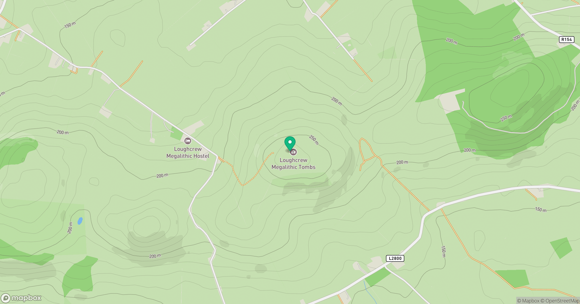
Grid reference: N586775
View on OpenStreetMapOpens a map in a new tab, centred on the hill.
No comments yet. Be the first.